Eigentlich will Hector ständig ans Meer, aber das schaffen wir dieses Jahr nicht so oft. Dafür haben wir das richtige Gespür, den einzigen regenfreien Tag der Woche in den Bergen zu verbringen.
Even though Hector yearns for the sea all the time, we do not live close enough to manage that often enough. Still, we have the right instinct to spend the sole rain-free day in the mountains.
Als ich 2017 das Wandern für mich entdeckt habe, war die Kampenwand ganz früh mit dabei. Es zeigt sich jedoch, dass rundherum viele weitere Wanderwege herumliegen, aus denen Komoot eine hübsche Rundtour gestrickt hat – Zeit, dass ich mir das näher ansehe.
I remember the Kampenwand well, it has been the second peak in 2017, back when I started hiking for good. Today is about the umpteen or hundreds other paths in this area, using the Komoot app for a nice loop tour.
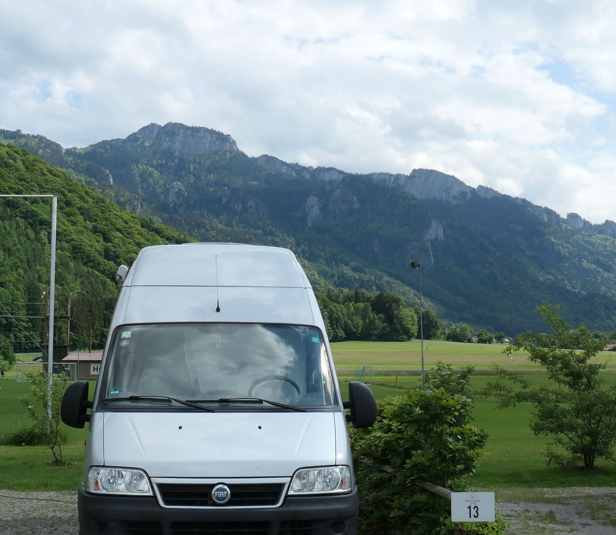
Ausgangspunkt ist der Camper-Stellplatz „Alpen-Camping Aschau“, den Hector schon länger im Visier hat. Vollautomatisiert, sehr hübsch und komfortabel, aber auch sehr teuer – das geht in Ordnung, solange hier alles so sauber und ordentlich ist, wie jetzt zu Saisonbeginn. Am besten finde ich, dass ich von hier aus zu Fuß nach Aschau downtown komme und den Einstieg in die geplante Wanderung gut erreichen kann.
Starting point is he area of “Alpen-Camping Aschau”, a new camper-park in this little town. The only real people involved are those cleaning the sanitary facilities every morning – all other functions or services are to be paid by card at the vending machine. Best of all is the closeness to Aschau itself as well as to a range of hiking routes.

Direkt neben dem Stellplatz locken ein Kletterwald und ein Natur-Freibad; im Hochsommer ist das hier bestimmt voll belegt mit aktiven Familien. Jetzt, im eisheiligen Mai, bleibt es tiefen-entspannt.
Hector (being sporty as hell) choses a spot close to the high rope course and almost in sight of the swimming lake. However, thanks to the chilly weather, none of this attracts me today.

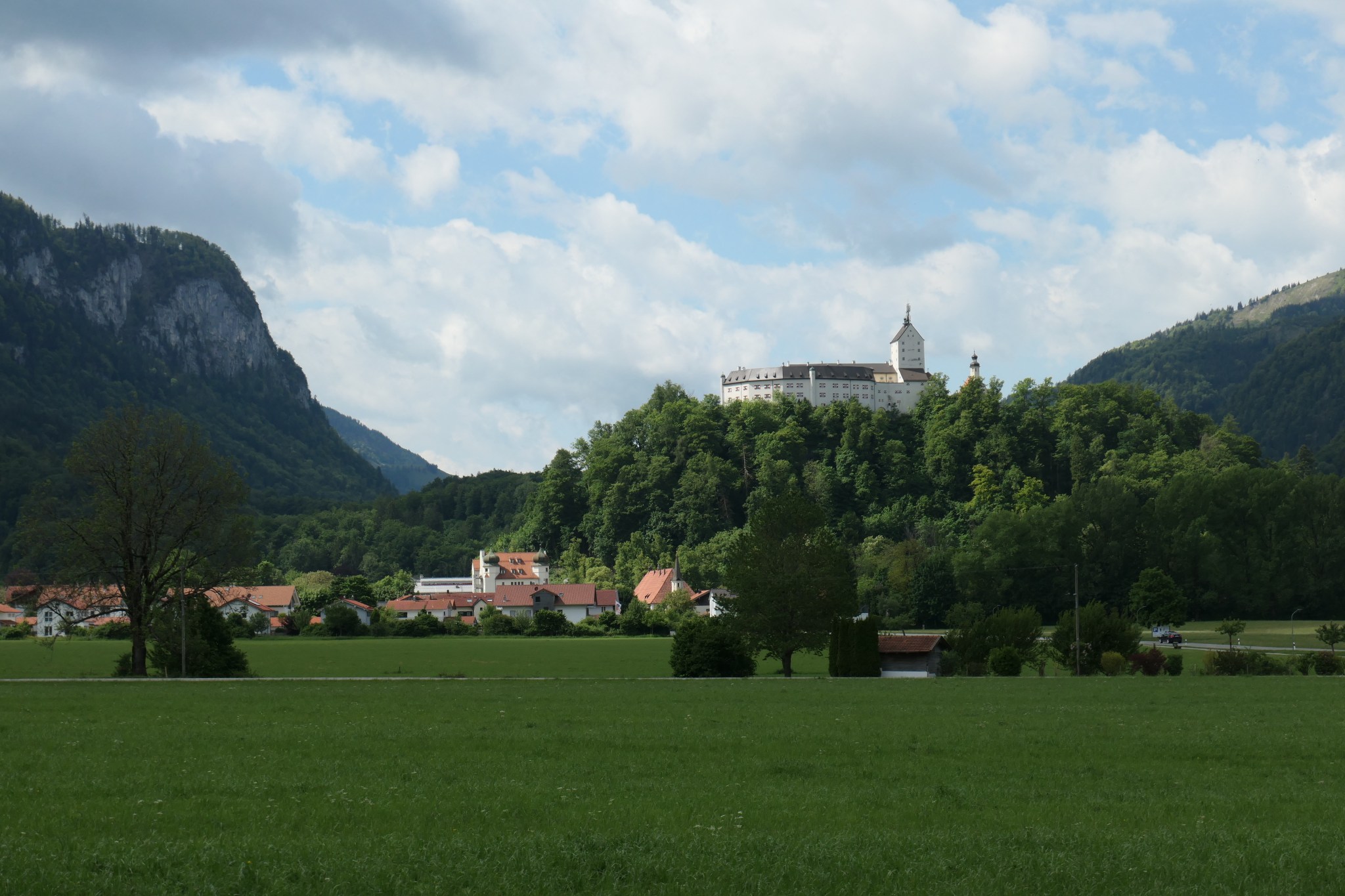
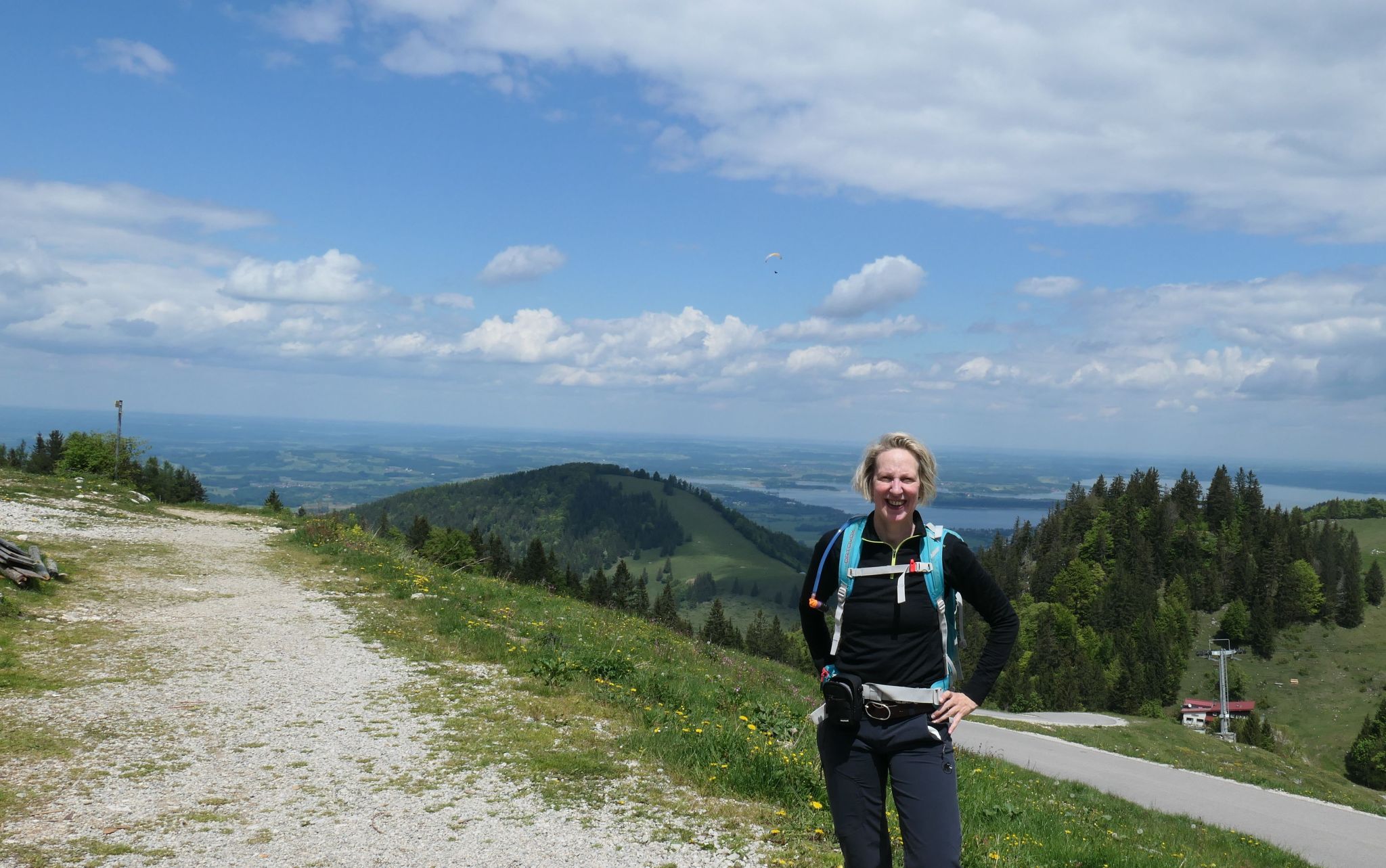
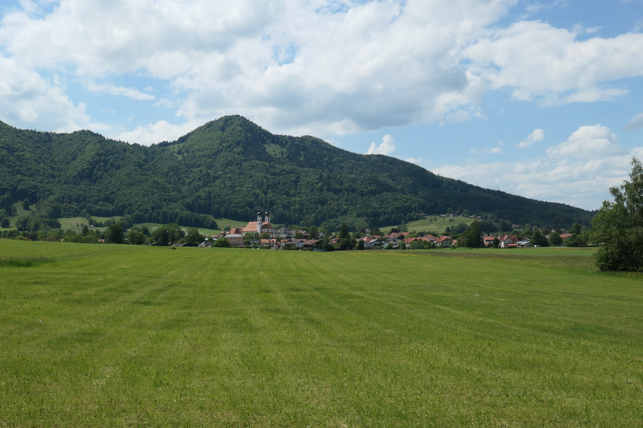
Die Wanderung führt mich zunächst vorbei am Städtchen Aschau, bietet schöne Ausblicke auf das Schloss Hohenaschau und erklimmt insgesamt 650 Höhenmeter. Aufregend ist das heute, weil ich das erste Mal seit Monaten ohne Kniebandage laufe – wollen wir doch mal sehen, wie fit & jugendlich ich noch bin.
The hiking tour starts with a nice view to Castle Hohenaschau, looking distinguished from a distance. When the path gets steeper, I wonder how well it will work out today, without the elastic bandage around my knee. Hopefully, I will feel younger and well-shaped once I get back down.


Die Wege bergauf sind abwechslungsreich: Etwas Asphalt, dann ein Forstweg, schließlich kleinere Waldpfade, alles ohne viel Trubel.
The route follows diverse paths and tracks, all pretty lonesome in a pleasant way.
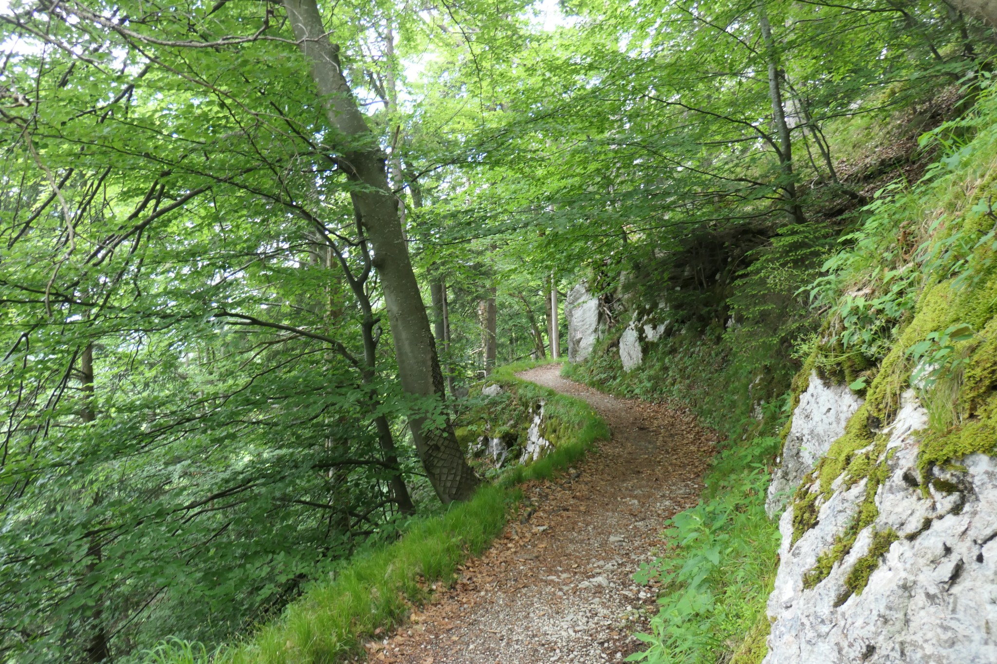
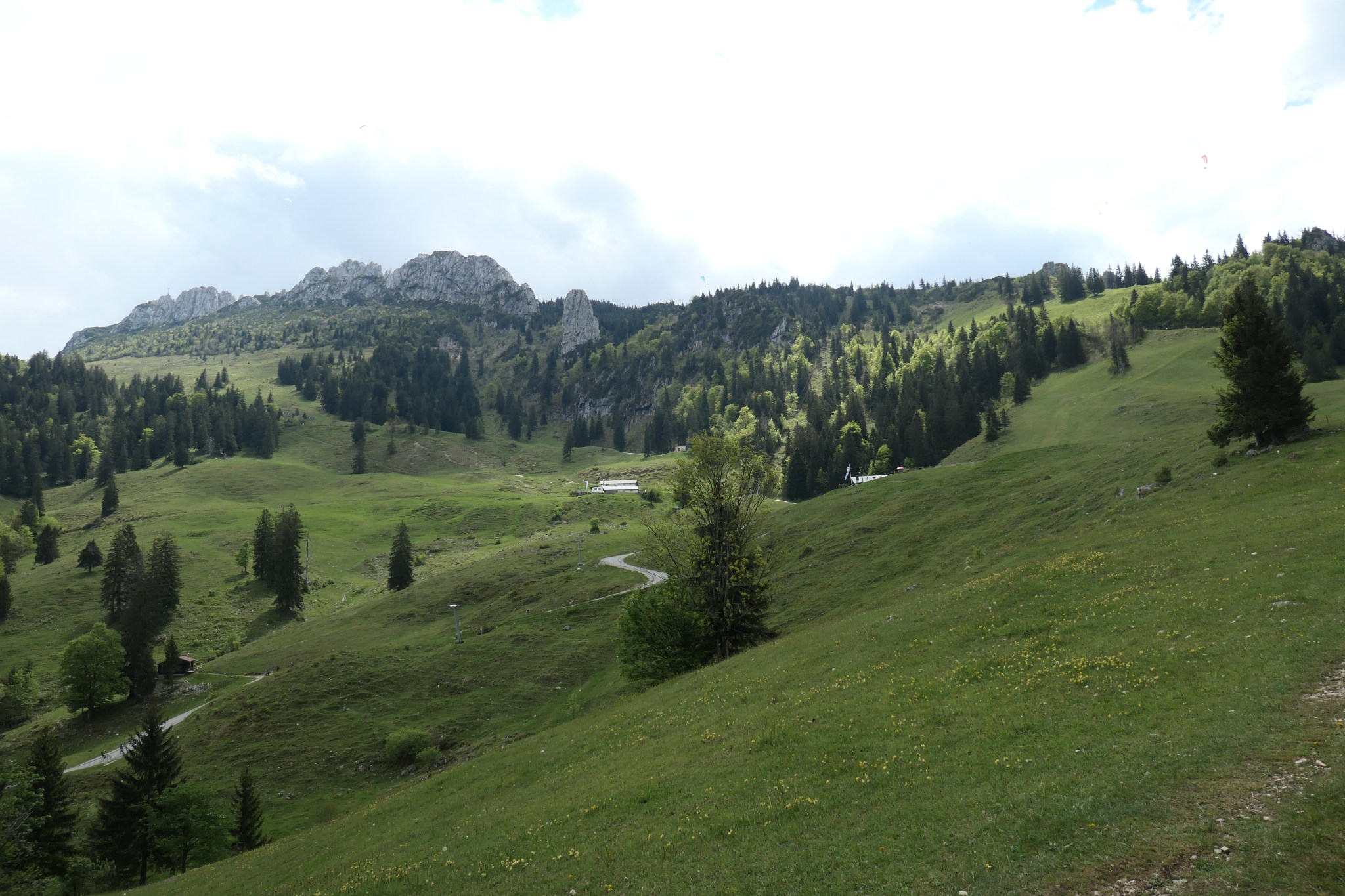
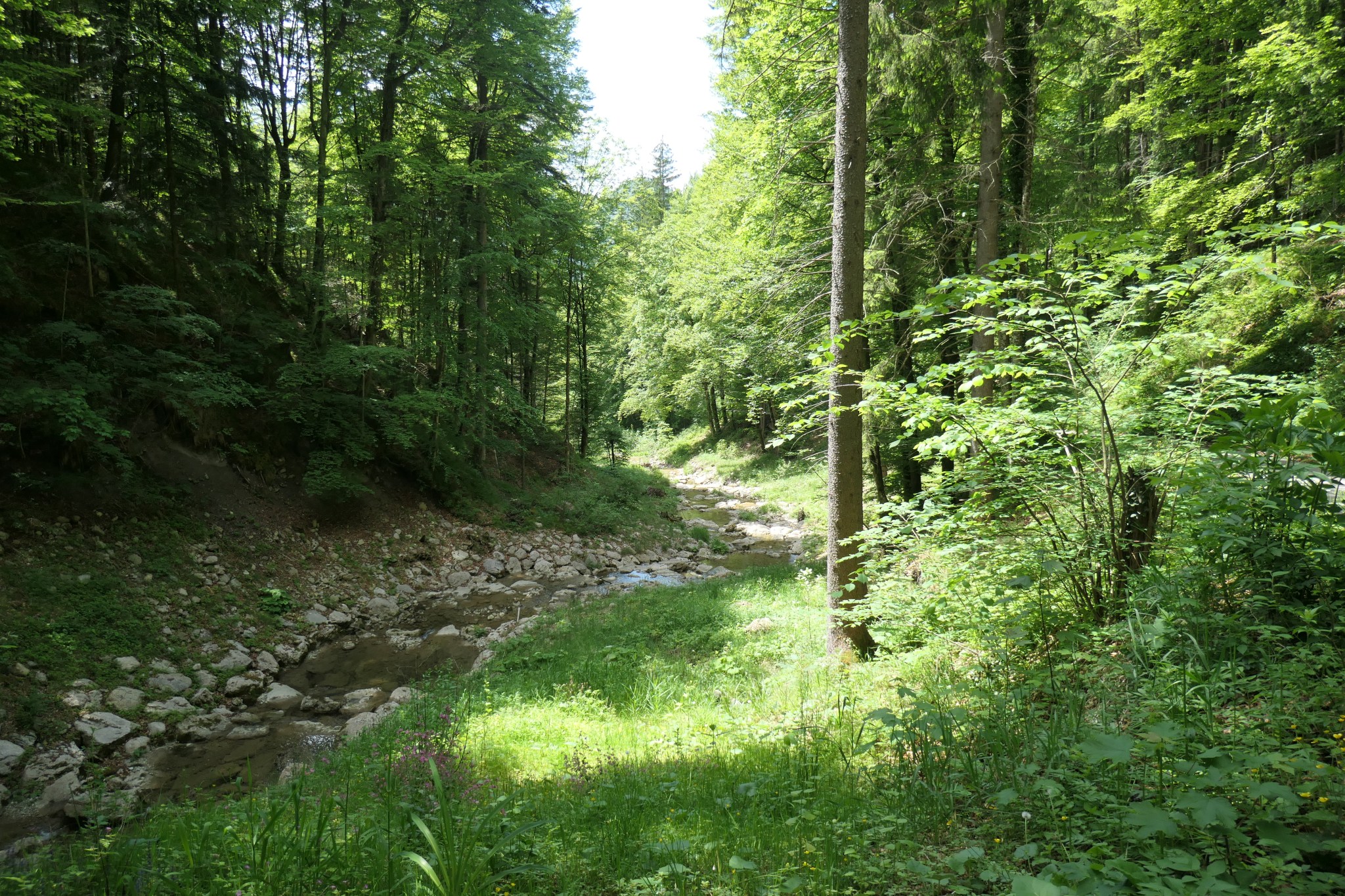
Der Weg kreuzt einen Bergbach und gelangt dann in felsige Höhen. Um jede Verzweigung, Abbiegung und Richtung mitzubekommen, laufe ich ständig meinem Handy hinterher. Um wieder mehr von der Natur zu sehen, stelle ich die Wander-App auf akustische Hinweise um. Jetzt sehe ich auch wieder Wege, Wälder und Felswände.
Passing by a vivid creek, I try to get a good routine with this mountain app. Finally, I switch Komoot to spoken indications for each turn, as I rather look around me in beautiful nature than following my phone all along.

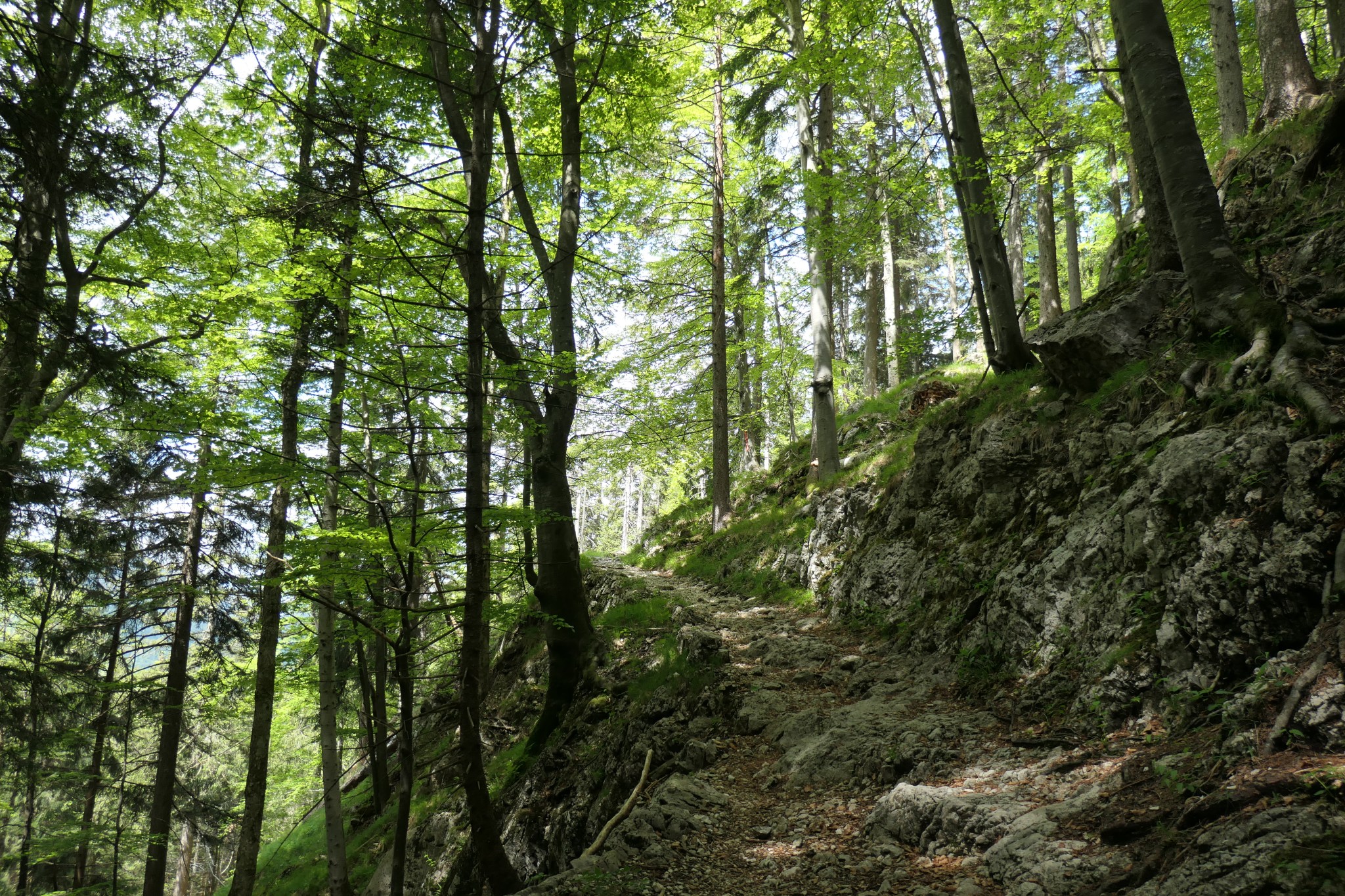
Obwohl Komoot eine eigenartige rechts-links-Schwäche hat, lande ich früher oder später wieder auf der richtigen Route. Mal steil bergauf über Pflastersteine, dann wieder sanft empor im Halbschatten der Bäume.
Guided by the app, I detect a funny weakness in it’s left/right-accuracy, still I manage to stay on my foreseen route. It varies from steep uphill passages to tender forest paths and is neatly composed.
Auf den letzten hundert Höhenmetern schwenkt die Rundtour auf die Haupt-Aufstiegsstraße ein. Einsames Schnaufen ist von nun an vorbei, dafür werde ich mit dem weiten Blick zum Chiemsee belohnt.
The final passage meets the main road, leaving lonesome phases behind. All effort is rewarded with a wide view over the lake Chiemsee.
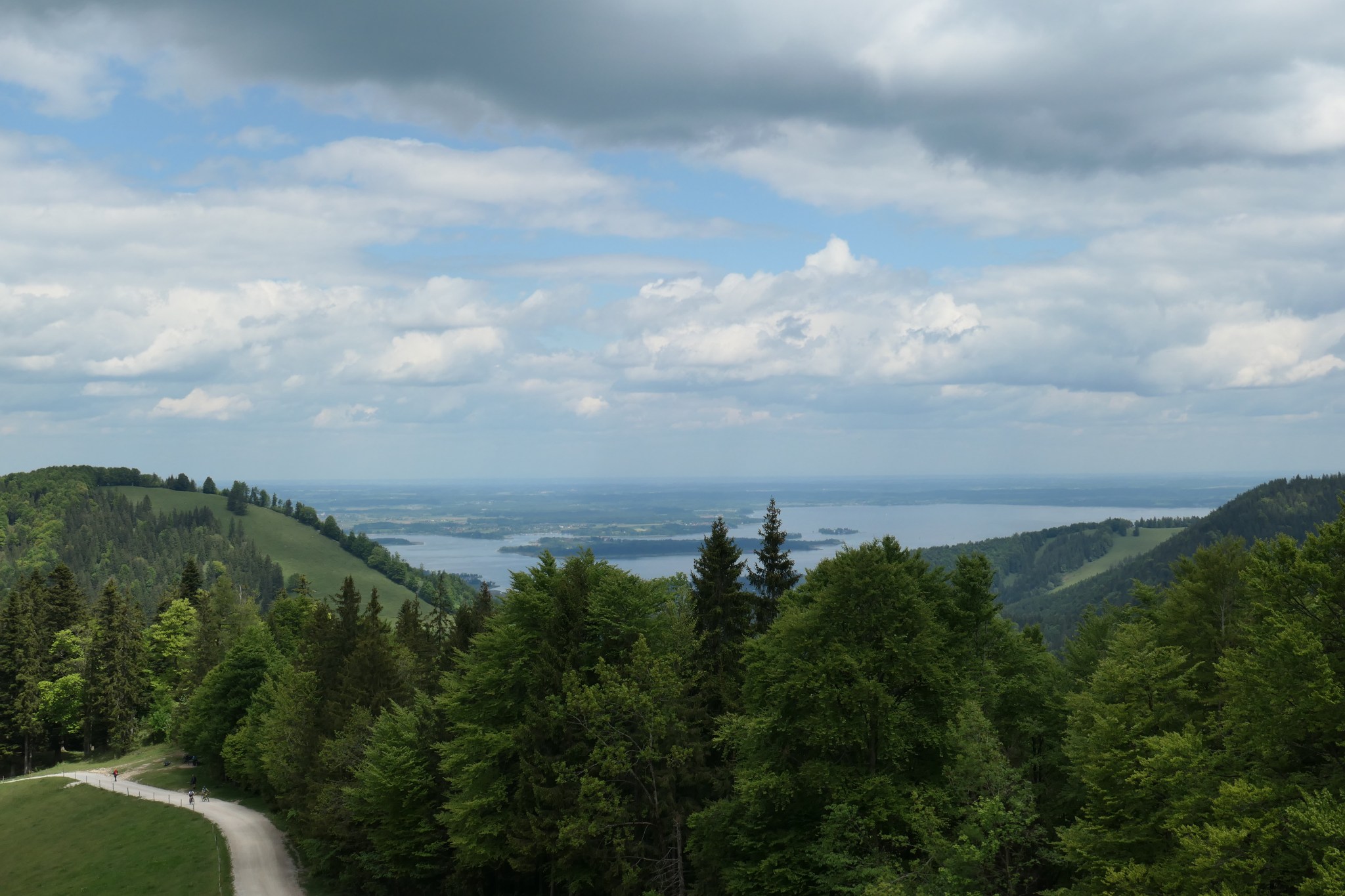
Nur ein paar Meter weiter oben schiebt sich die mächtige Kampenwand ins Bild. Je nach Standpunkt sehe ich: oben = Kampenwand, unten = Chiemsee. Zwei Welten.
Finally, the huge rock of Kampenwand comes in wight. The full picture now is like two sides of a medal: Kampenwand to the right, Chiemsee to the left.

Die Winde sind heute günstig für Paraglider, und ich denke: DAS steht auch schon viel zu lange auf meiner Liste. Wie gut, dass ich am Abend noch beste Empfehlungen für Tandemflüge erhalte, auch wenn ich das jetzt noch nicht wissen kann.
The cold wind is in favour of the paragliders, and I think: THAT is on my bucket list ever since and still not realized. Lucky me that I will get first-handed experience and recommendations this evening – even though it is beyond my knowledge right here and now.

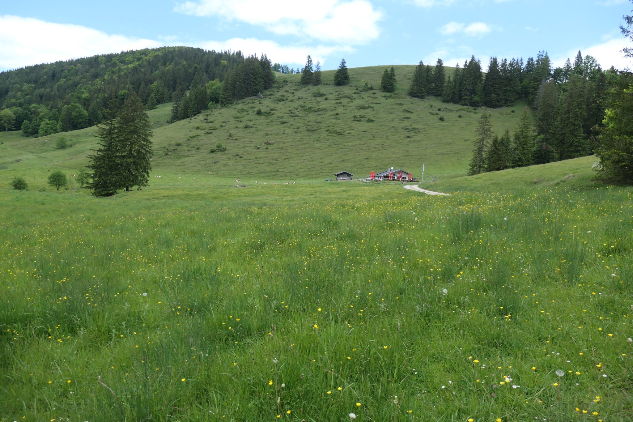
Am höchsten Punkt meiner Rundtour steht die Gori-Alm. Am Berg weiß man ja nie, wie sich das Wetter entwickelt und wann es wieder was zu essen gibt, also kehre ich natürlich ein. Kaum bin ich frisch gestärkt, kommt auch die Sonne wieder raus.
Turning point of today’s loop is the Gori-Alm, offering food and coffee for exhausted hikers or other tourists. Mountain pros like me never ignore a good opportunity, hence I settle down for lunch. Smart move, as the sun needs just that little pause to come back with bright, warm rays.
Der Weg bergab ist gut zu gehen, wenn auch etwas fade – Asphalt wechselt sich ab mit Schotterabschnitten, aber die Almwiesen rechts und links sind natürlich trotzdem hübsch.
Downhill, I follow the main road, partly asphaltic and partly a dirt road. It may be a bit boring, but gets well-balanced by the nice scenery around it.

Am Ende bin ich nach meiner etwas erweiterten Bergtour noch so fit, dass ich Aschau halb umrunde, bevor ich mich auf die Suche nach Speis und Trank mache. Das, oder ich bin dann doch noch falsch abgebogen…
Back down at ground level, I am fit enough to surround the city of Aschau before finding a place for dinner and drinks. At least that is what I tell myself after I have taken the wrong turn along the way…
Das Fazit ist jedenfalls erfreulich: Mein Knie ist um Jahre verjüngt, ganz ohne Ersatzteile. Und die Bergwelt des Chiemgau ist eh immer eine Reise wert – ob mit oder ohne Gipfelkreuz.
I am more than happy with today’s tour: my knee tells me about traces of youth, thanks to weeks and months exercising. And even a neat hike without severe peaks is nice enough in the region of Chiemgau, marking this short trip a full success.
| 650m altit. difference | 14 km | 3,5h | harmless |

Leave a comment