
Why do I get up at 4:30 a.m. on a free Saturday?
Because serious mountain tours might need a buffer for the unforeseen.

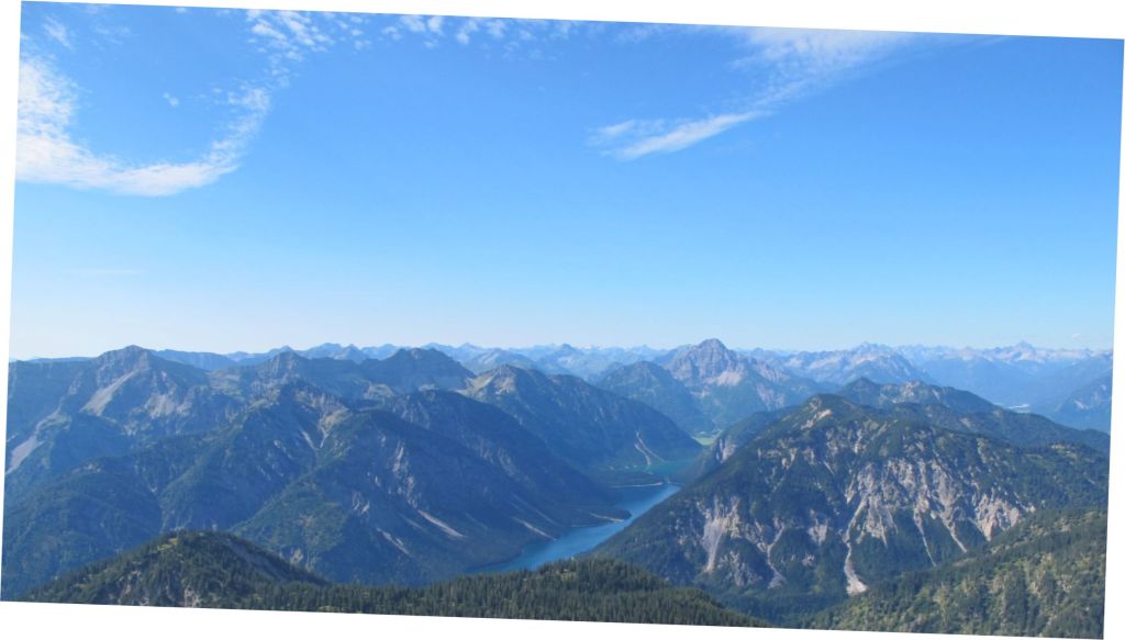
Together with experienced hiking buddy Gunther, we start at 7:45 at the Plansee and make our way towards the Geierköpfe. The tour description says something about 1.240m altitude difference spread over 10,8km. So much for the theory of it.

The trail is multifaceted, sometimes mellifluous and sometimes rough, and we gain height rapidly. Almost right from the start, we are rewarded with beautiful views over the Plansee and the Ammergauer Alpen.
Having learnt from my previous hike, I assert slow but steady speed and within less than 3 hours, we arrive at the Western summit of the Geierköpfe-triptyche.
Despite the early hour, quite some hikers gather up here. I am motivated as a chamois, all fit and enchanted by our surrounding. From the Westgipfel, a trail follows the ridge towards the main summit. Of course, we will continue to the next level, no doubt about our peak performance!

Every here and there, the flanks of the ridge leave only inches for a small trail, but most of the way is wide enough for comfortable footsteps.

After all, this is exactly the setting that I prefer for a serious mountain tour. I like the sensation of a spectacular surrounding and enjoy every minute up here.

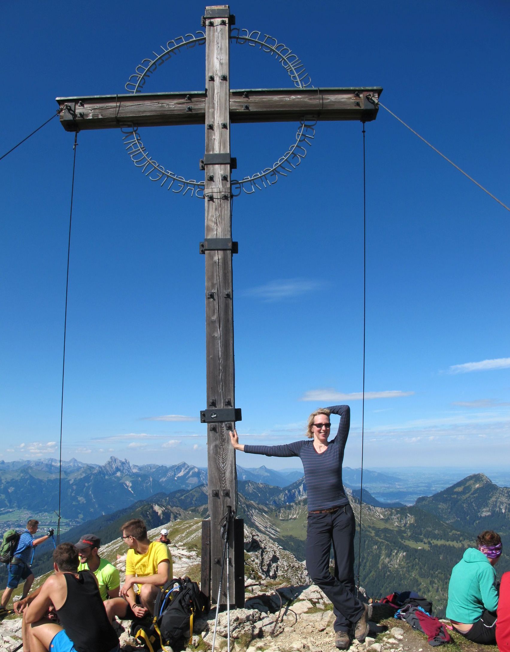
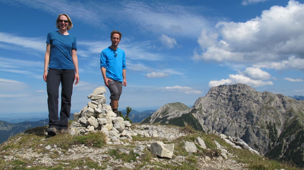
The final sprint to the main peak is seriously uphill on dry gravel and brings us to a halt on 2.161m above sea level.
The cross comes with a rough DIY charm, but just like us: at least it made it up here! Thin air and chats with other hikers pave the way for the decision of the day: Come on, it is all so great, let’s continue to the third of the 3 peaks!

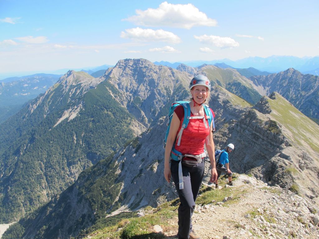
That being said, we put on our helmets (decent detail when climbing in crumbly rock) and off we go.
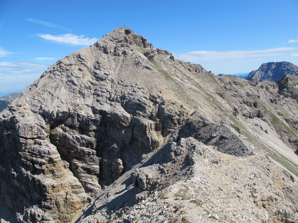
The description from here on is vague, but mentions something about “free climbing level 2” – something I have not experienced yet and hence do not worry too much.

The trail becomes more and more interesting. Intense, even. It certainly is not a bad idea to remain concentrated, especially when seeking the best route down the climbing passages that enrich the way between main peak and Eastern peak.
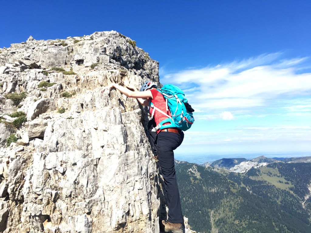
Looking for the announced climbing section and having no clue of what that might look like, we come to a halt at a dead-end rock. The only way further is either via (under) overhanging rocks or down a vertical crag. Hm…

Even I have some doubts if this is the right way and/or if it suits our abilities. Lucky us that 4 youngsters come their way with one of them having experienced the route some years ago. He confirms that the climbing of this tour is much more harmless than the walls beneath our feet. Light-hearted, we follow the know-how-guys to the 3rd peak and find it all easy enough.
What comes next is learning: It slowly dawns on me that the 1.240m altitude difference include only the Western peak with the same being true for the expected total of 6 hours. As of now, we enjoyed our hike for full 5 hours and now have to figure out how to get back and down. Option A: Straight back on the same route, including climbing and ridge and quite some loss-and-regain of altitude meters. At this point, it seems that option B is the more reasonable one: Cross-country straight down until we reach a horizontal (or so it seems) path, accept a bit of a opposing climb and then, finally, get down.

We go for B and I find myself swearing and grumbling. The mountain pines jump in my way, the so-called horizontal trail is an up-and-down rollercoaster and the entire distance more than I have asked for. Still, I would not trade our tour for any lazy hour on the couch. It takes some effort to be here, but I am willing to appreciate the sweat and the muscle soreness!

The last third of our descent tempts us to a half-knowledge decision: A short note in the tour description recommends a sideway via Schönjöchl – it just forgets to mention that it includes passing by a forth peak and adds about 150m altitude difference! Half way to it, we perceive the hard facts and turn around, finally taking the original way down. Around 6:00 p.m. we are back and safe at the Plansee, greedy for a portion of French fries and yearning for laziness on the sofa.
With all sidesteps, trials and detections, we had been en route for full 10 hours, walked up and down roughly 1.700m on a track of ca. 15km. Hard to imagine anyone better for such a tour than hiking bro Gunther – thanks for company, planning and fantastic pictures. The greatest mountain tour I ever experienced – all great!
| >1.600m altitude difference | 14-15 km | 10h | challenging |

Leave a comment